Speakers Will Highlight Effective Track and Trace Programs and the Transformative Impact of Business Intelligence on Utilities Through Client Use Cases
GREENWOOD VILLAGE, CO (October 28, 2022) — Multiple leaders from Locana, an international leader in spatial technology, will be featured speakers on October 31 and November 1 at the Esri IMGIS conference in Palm Springs. Their three presentations will focus on best practices for building successful Track and Trace programs, innovative techniques for rapidly locating and mitigating gas network leaks, and a case study of a gas utility implementation of a modular field asset data collection solution.
“The operational and business insights gleaned from location data are invaluable for tackling the most complex challenges that organizations face…”
— Mike Eggenberger, Locana Vice President of North American Sales
- Oct. 31 at 1:30 p.m. – Track and Trace: Field Maps, Barcoding with EAM and OQ Integrations
Bruce Taylor, Locana Utilities Industry Lead, along with a representative from Suburban Consulting Engineers will share about how field maps empower organizations to develop effective Track and Trace programs. They will discuss how Track and Trace should be integrated with Enterprise Asset Management (EAM) and Operator Qualifications (OQ) systems for accountability. They will cover Track and Trace integration and field operations best practices with real-world examples. For more information, click here, then scroll down to the filter area. - Nov. 1 at 8 a.m. – Gas Utility Network Management
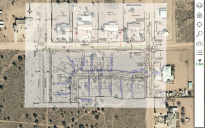
Jeff Archer, Pre-Sales Solution Engineer and Principal at Locana, and Shahid Hasan, Lead Work Management Analyst at Washington Gas, will share about how Washington Gas Light Co. (WGL) and Locana implemented a mobile GIS solution for leak centering to improve the efficiency and speed of gas leak investigations and repair crews. The Lemur field GIS product is used to collect leak reading and centering information in an integrated end-to-end solution that includes SAP’s Work Manager, Esri ArcGIS, and WGL’s ARM leak repair software. Lemur enables technicians in the field to collect leak data that is stored in the GIS and linked to the SAP Work Order for all systems in the leak investigation and repair workflow. For more information, click here, then scroll down to the filter area. - Nov. 1 at 9 a.m. – Gas Utility Tracking and Traceability
Katie Scheurer, GIS Solution Architect at Locana, will present on a panel with representatives from Suburban Consulting Engineers and South Jersey Gas about how with the adoption of the PHMSA Mega Rule, South Jersey Industries (SJI) needed a robust and flexible way to collect high-accuracy asset data and track it throughout its lifecycle. SJI partnered with Suburban Consulting Engineers and Locana because of their complementary engineering and GIS experience. This team developed a comprehensive, modular gas utility field asset data collection solution, which solution provides real-time integration between field data collection devices, enterprise GIS, EAM, master material lists, and OQ systems to provide traceable, verifiable, and complete utility asset data. For more information, click here, then scroll down to the filter area.
“The operational and business insights gleaned from location data are invaluable for tackling the most complex challenges that organizations face,” said Mike Eggenberger, Locana Vice President of North American Sales. “At Esri IMGIS, Locana leaders will share how Track and Trace programs enable a single source of truth for maximum benefit. They’ll discuss utility client use cases for leak centering and field asset data collection that are great examples of the transformative power of location intelligence. And they’ll show how the integration of enterprise-wide data and powerful analysis capabilities ensure successful outcomes, drive innovation, and provide a secure, modern approach for the future.”
About Locana
Locana, a location and mapping technology company, provides software products and services that solve the world’s most pressing business, climate, and social challenges. With more than 20 years of experience, Locana is a global leader in both enterprise geospatial solutions and innovative applications using proprietary and open‐source mapping technologies. By taking a location‐first approach to problem solving, Locana builds, implements, and connects solutions for public and private customers, in a wide range of domains including: utilities, land and facility management, critical infrastructure, defense, conservation, international development, and technology, among others. With headquarters in Denver, Colo., the company also has major offices in Seattle and London. For further information visit: www.locana.co or https://www.linkedin.com/company/locana-co/.
###
Editor’s Note: Interviews with company executives are available upon request. Photos and other information can be obtained by reaching out to the media contact below.
Contact:
Jennifer Dulles, APR
DStreet for Locana
Phone: 303-956-0001
Email: jdulles@dstreetpr.com


