

Locana has published the new mobile app of the Forest Service Interactive Visitor Map, now including Offline caching, locate me and other new enhancements.
This work distinguishes Locana as the go-to mobile application developer for federal agencies. The mobile IVM application demonstrates not only Locana’s proven, expert skills with geospatial mobile application development, but also our fluency with federal requirements for mobile application publication. The free application is now available for download in App stores for both Android and iOS – just search for ‘Visitor Map’.
A little more about the App:
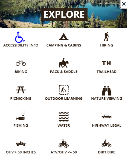
The Interactive Visitor Map (IVM) helps the public understand how and where to access the outdoor activities they love. Displaying trailheads, campgrounds, fishing access, trails and roads, the IVM Application allows users to select any National Forest, zoom there, and explore all available recreational opportunities. By clicking on individual campgrounds, users can learn more about when they are open, how many sites are available and what type of camping is allowed. The app even allows you to reserve campsites before you travel, through recreation.gov. Similarly, users can see which roads and trails are open to various uses (OHV, hiking, mtn biking, etc). Users can toggle among various base maps, including topographic maps and satellite imagery, for example. The app even maintains all functions offline when users are recreating outside of cell range.
Locana worked directly with Forest Service staff, the CIO and the Office of Communications to develop and test the app, pass all required security scans, and publish the app as the first national scale authoritative Forest Service mobile application.
Android: https://play.google.com/store/apps/details?id=gov.usda.fs.gtac.ivm
IOS: https://itunes.apple.com/us/app/visitor-map/id1459414948?ls=1&mt=8


