
Why Companies Will Rely on Integrated GIS, IoT, Machine Learning, and More to Build and Maintain Modern Facilities
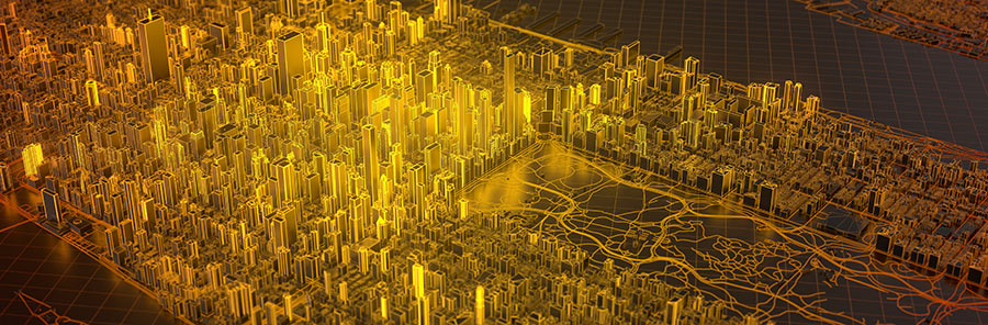
The digital twin revolution
Infrastructure businesses face enormous pressure to deliver economically viable and environmentally sustainable facilities. And more organizations than ever, in utilities, construction, mining, insurance, and more, are developing digital twins to achieve these objectives. That’s because digital twins provide the unrivaled insights and connectivity required for efficient, productive, and sustainable infrastructure. Indeed, in 2021, the global digital twin market was valued at approximately USD 7.5 billion. And it’s projected to grow at a compound annual growth rate (CAGR) of 39% from 2022 to 2030.
Digital twins are virtual representations of the physical world, including assets, processes, relationships, and behaviors. They allow organizations to accurately understand their facilities using a 3+ dimensional view to operate and evaluate natural and built environments. Moreover, they uniquely integrate different digital models and provide in-depth information about infrastructure.
The challenge for many businesses looking to deploy digital twins involves understanding the best technology options available. Moreover, developing an optimized digital twin is labor-intensive. Luckily, there’s a solution.
Modern, open geospatial systems provide a perfect foundation for building a digital twin that both leverages existing investments in data and technology as well as provides an integration platform for the future. They seamlessly connect to existing enterprise systems and combine CAD, GIS, remote sensing, imagery products, and asset management systems for a holistic solution that includes advanced modeling and analysis tools.
Overcoming traditional limitations with digital twins
For decades, managing networks, facilities, and infrastructure involved complex engineering tools, CAD software, mapping tools, manual processes, and lots of fieldwork, all in a 2D format.
Digital twins bring an additional dimension to the process, providing a platform for augmented and virtual reality views that are both intuitive as well as data-rich and accurate. They allow utilities, for example, to stream data from the cloud easily and visualize utility assets in real-time – arriving at the 4th dimension of spatial-temporal insight. This type of digitalization means business leaders can access the data they need when they need it in a graphic format that allows for deeper insights than a traditional CAD instance or computer dashboard. They leverage cloud-based solutions as a means of providing security without having to invest in new hardware.
Moreover, digital twins provide companies a means to transition from only relying on human capital to properly managing asset data using digital tools, automation, and data management techniques. Companies streamline processes when they replace manual methods that require physical travel to inspect the network.
And as more technicians and operators retire, digital twins offer a robust means of data capture for collecting, managing, and sharing decades of “institutional knowledge” that might otherwise be missed.
Digital twins also make it easier to leverage your human resources in newer, more efficient ways. Your tech-minded staff can visit things virtually, requiring fewer knowledgeable experts extended across more of your facility footprint. They can perform all types of work using a virtual digital twin, from remote training to asset construction, inspection, and replacement planning. The spatially accurate digital twin acts as a resource to feed augmented reality (AR) experiences by the next generation of infrastructure operators and maintainers.
And they gain better situational understanding with a digital twin that accurately represents what’s in a given location using live data combined with other information. You can understand issues with a digital twin without sending people into dangerous situations. Combined with IoT, you can use a digital twin to render and inspect assets without putting human health and life at risk.
Providing access to your digital twin enables expertise outside the organization to solve problems on demand without adding more people with specialized experience on staff. It extends the power of knowledge over space, making it easy to perform remotely guided troubleshooting to get services back online faster.
The challenges to digital twin success
While the potential benefits of leveraging a digital twin can be enormous, the challenges involved in creating and maintaining them can be daunting. In addition to selecting the technologies that serve as the basis for building your digital twin, you must consider data capture, updates, data feeds, as well as how to provide access and facilitate collaboration. Ensuring a digital twin based on accurate data continuously updated by multiple stakeholders across departments enables enterprise adoption and upkeep that brings constant value to your organization and customer.

Capturing data — Digital twins require an engineering-grade depiction of physical objects that comprise your facility or network. This means you must digitize additional asset data, whether for an indoor building or external network, as well as the high-resolution scanning to get the end product right. Lidar and other three-dimensional imaging technologies combined with computer vision and machine learning technologies offer low-cost options for capture at scale.

Change detection — Once you have an initial iteration, how do you develop a program to detect change? How do you ensure that when change occurs in the physical reality, updates to the digital counterpart get made? Organizations need a method to detect and react to changes in a real-time environment. They should also be able to identify and resolve execution differences so that communications are consistent and accurate.

Integrating real-time data feeds — Using the investment in the digital twin, you can you integrate other types of real-time feeds to your sensor and IoT platforms to enrich that digital representation. This allows you to see things with a visual context in real-time.

Collaboration — Like most modern tools or solutions, a digital twin ideally should exist enterprise-wide and not at the departmental level. They should be accessible to multiple departments to facilitate collaboration projects, from engineering and design to safety and compliance, vegetation management, and much more.
The digital twin solution: GIS
Modern, open GIS provides an integration platform that makes it easy to consume and publish infrastructure information using web services. It enables organizations to connect systems such as advanced distribution management systems (ADMS), building information management (BIM) systems, supervisory control and data acquisition (SCADA), as well as ERP-based applications like work management, asset management, and customer financials.
Organizations leverage spatial and related tabular data to create digital twins representing infrastructure, assets, and surrounding built and natural environments. They can effectively abstract, model, and analyze facilities, as well as use machine learning and AI to perform predictive analytics. Users can combine data from traditional GIS with CAD, imagery, and live data feeds to increase safety, improve service, and enhance performance and profitability.
Using a spatially enabled, model-centric view, a GIS-based digital twin allows users to monitor assets within a 3D environment that accurately reflects the actual network.
And GIS provides the perfect platform for digital data capture and maintenance efforts using mobile solutions. As more modern methods evolve, such as robotics and machine learning, GIS also makes it easy to connect new capabilities that take raw image products captured from an optical sensor or laser point cloud to develop a finished digital twin data product.
And the future of these spatially enabled digital twins is exciting. You will see the convergence of engineering and facilities operations with metaverse and social platforms. And modern open geospatial technology can play a role by helping set standards so these twins can be chained together and accessible. Users can digitally traverse from one twin to another or buy a 3rd party digital twin of a facility. A modern platform allows more business models through an open-source standard that allows many people to build to a single digital twin.
Transform faster with a digital twin expert
For businesses looking to deploy digital twins that optimize network performance while meeting business needs and delivering customer value, you’re in luck.
For decades, Locana has been a trusted partner supporting infrastructure businesses at every stage of the digital value chain. Specifically, we’ve worked with clients of every size and industry to assess the opportunities and craft a plan to implement world-class geospatial and digital twin technology that achieves desired business outcomes in record time.
We maintain industry and IT expertise using a customer-first, design-driven methodology. We work closely with clients to design and deliver a precise geospatial solution for developing a digital twin that’s future proof and scalable. Our collection of leading consultants, architects, designers, developers, and GIS professionals can provide deep experience and proven best practices for ensuring success.
***
Want to build a modern, GIS-based digital twin for your organization? Contact us. Or visit our services pages to learn more.


