
Integrate
Achieve Seamless Integration That Modernizes Your Enterprise

Spatially enable your business systems
Across industries, more organizations are accelerating their digital transformation strategies to exploit the explosion of available data, including location intelligence. Yet many lack the sophisticated processes and patterns for connecting and dispersing GIS data from any system throughout the enterprise.
Locana can help. Our staff maintains deep technical and business process knowledge. As a result, we can design, implement, configure, and connect GIS with your business systems to spatially enable your enterprise. We can help you deploy modern software like Esri ArcGIS Enterprise and the Utility Network to increase efficiency in daily operations, plan projects, and respond to events. As a result, you can do more than just mapping—you can leverage geospatial insight for better decision making.

With Locana, you can use maps and location intelligence to achieve:
Operational efficiencies and streamlined workflows
Lower costs and reduced resource management
Greater information access and collaboration

Improved decision support and dynamic situational awareness
Geospatial solutions that deliver
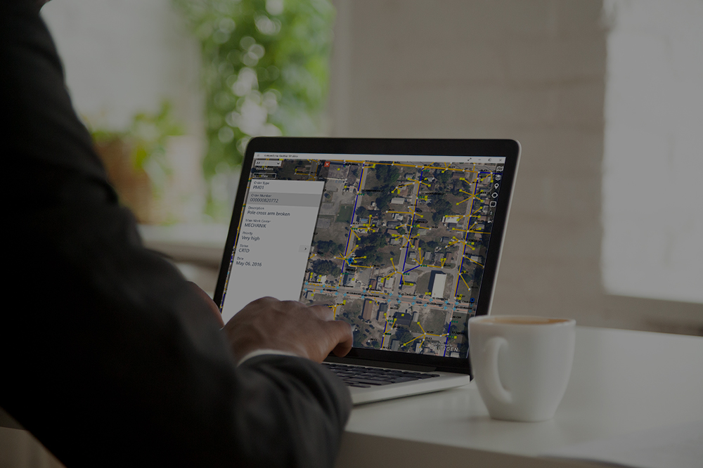
Locana can help you link your GIS data to various application areas, including project controls, asset management, field service, sensors, IoT, OMS, and more. We employ business-first approach to assess your needs. We then use sophisticated patterns and proven techniques to integrate your information systems and migrate legacy or department GIS into the corporate enterprise. Moreover, we understand proprietary GIS and open source, meaning we can deliver the right solution based on your unique objectives.
Advanced geospatial solutions
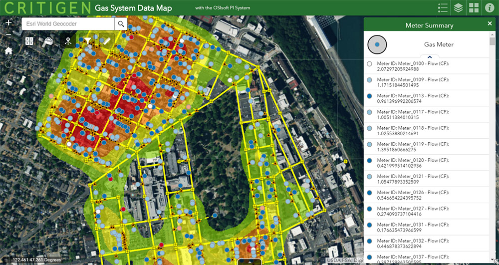
We’re leaders in mapping and location intelligence. We can help you harmonize systems to harness innovative maps, analytics, and dashboards for a real-time view of operations, people, services, assets, and events.
Proven methods
Our clients span the spectrum, serving in both public and private sectors, from start-ups to global brands. We employ best practices and innovative solutions to maximize enterprise software and improve business performance.
Maximum value
We align business objectives with IT capabilities, creating value for users and stakeholders alike. And we develop solutions that meet immediate goals and anticipate future needs, ensuring lower cost of ownership.
Learn more

Maximize Your Data Value with Spatially Enabled IT/OT Integration

Why Location-based AI Is the Right Choice

Modern Geospatial Delivers Innovation

Implement a More Efficient GIS-ERP Integration Following a Few Simple Steps
The Locana difference
Locana’s technical knowledge, collaboration methodologies, and flexible approach enable you to achieve your business goals using connected software. Our extensive work and deep partnerships with PwC, SAP, SPC Engineering, Esri, Oracle, OSI Soft, and others mean we know what it takes to ensure your digital transformation success.
![]()
Proficiency in designing, building, configuring, and connecting systems

Decades of geospatial experience serving a global client base
![]()
Extensive enterprise geospatial data and software expertise
![]()
Track record of delivering successful projects on time and budget
![]()
Partnerships with IT and professional service leaders
Connecting geospatial technology to value
Don’t let departmental GIS or system silos stop you from bringing location intelligence and mapping to your entire organization. Our depth and breadth of systems integration experience give us unique abilities to unlock, organize, and geo-enable data from your information systems. We work with you to develop targeted workflows, models, and dashboards that improve operational efficiencies and decision support.

Let’s connect
Find out how we can serve you and your industry by contacting us directly below.

At Locana, we believe maps and location intelligence can help solve the most pressing infrastructure, sustainability, social, and business challenges.
At Locana, we believe maps and location intelligence can help solve the most pressing infrastructure, sustainability, social, and business challenges.
Locations
United Kingdom
© 2024 Locana