
Map
Maximize Your Mapping with Locana

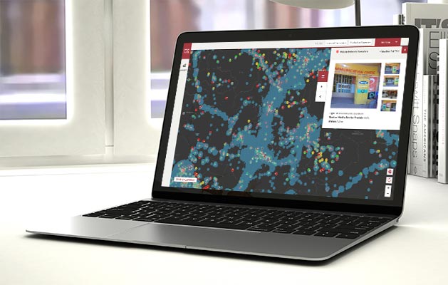
Turn location into opportunities
Data-driven organizations looking to gain a competitive advantage in today’s digital economy recognize the value geospatial technology offers. But trying to glean insights from the onslaught of available location-based data—from disconnected databases to siloed business systems, mobile apps, sensors, imagery, and more—has never been more challenging.
With Locana mapping services, you can prepare data and establish the proper protocols to visualize, analyze, and share maps and location intelligence wherever it’s needed. Get the most out of your GIS investment to deliver value to the organization. From as-building, automating, and optimizing data pipelines to setting up governance and stewardship processes, we have the skills, knowledge, and experience you need.

Locana mapping services help you with:
Data collection

Data conversion/migration

Data curation
Data aggregation
Data publishing
World-class consultants ready to serve
You can ensure your geospatial data is aligned and available when and where you need it across the enterprise. Locana’s world-class consultants leverage decades of real-world experience and proven best practices in implementing solutions to consolidate, migrate, cleanse, provision, and manage a rich array of data.
Partner with geospatial leaders
Engage with world-class geospatial experts experienced in implementing robust mapping systems and applications, across public and private industries worldwide.
Apply cutting-edge capabilities
Improve operations and decision support with the latest innovative GIS and business system capabilities. Leverage open, flexible, and scalable solutions that empower staff to succeed.
Maximize location-based value
Get the most out of your IT and GIS investment through modernized data and infrastructure, improved workflows, and enterprise-wide mapping access.
Learn more

Modern Geospatial Delivers Innovation

City of San Diego Selects Lemur to Deliver GIS Data to Mobile Work Teams

Geospatial Technology Opens Access and Promotes Gender Diversity in STEMM
Improve Your Design Efficiency and Accuracy with Combined GIS and EAM
The Locana difference
Use data-driven maps and dashboards to communicate your cause in the most intuitive manner possible. Location analytics help transform complex ideas into discernable action, delivering the key to advocacy that creates a sustainable future.

Decades of experience serving a global client base
![]()
Experts in proprietary and open source software
![]()
Deep knowledge in geospatial data preparation and management
![]()
Side-by-side collaborators trained with a flexible approach
![]()
Proven track record delivering high-performance, self-sustaining projects
Discover the location advantage
Take a deeper dive into the value of modern geospatial solutions.

data sheet
Drive Digital Transformation with Locana Solutions and Services for Utilities
Eliminate silos, optimize operations, and deliver customer value with modern geospatial capabilities.
Make mapping your advantage
Locana’s mapping services help you make better business decisions using high powered data visualization and location-based insights. Take advantage of the locational aspect of your data to make better decisions at every level of the organization.

Let’s connect
Find out how we can serve you and your industry by contacting us directly below.

At Locana, we believe maps and location intelligence can help solve the most pressing infrastructure, sustainability, social, and business challenges.
At Locana, we believe maps and location intelligence can help solve the most pressing infrastructure, sustainability, social, and business challenges.
Locations
United Kingdom
© 2024 Locana