Government
Digitally Transform Your Agency with the Power of Location


Locana services and solutions help build better communities
The business of government has never mattered more. Agencies today must contend with a host of critical issues, including a global pandemic, climate change and extreme weather events, economic recovery and infrastructure investment, and sustainability. And the mission remains the same—to improve the quality of life for people and communities.
Locana has worked with federal, state, and local departments for decades to transform how they operate and serve their constituents with modern, agile geospatial solutions. Today, more agencies than ever leverage Locana’s expertise and experience to advance enterprise geospatial programs and launch projects based on impactful workflows and trustworthy data.
Data-driven government for the people
Whether maximizing your existing investment or building new capabilities, Locana can work with you to develop modern enterprise GIS that works across departments and into the field. You can create a data-driven government enterprise to improve organizational and operational efficiency, execute your data vision, and scale transformation across your business and workforce.
Replace manual and paper-based methods, streamline service delivery, and enhance communication and transparency using the power of location intelligence. As a result, you can improve critical decisions about land management, facility and asset management, emergency preparedness, transportation, and more.


Locana helps government:

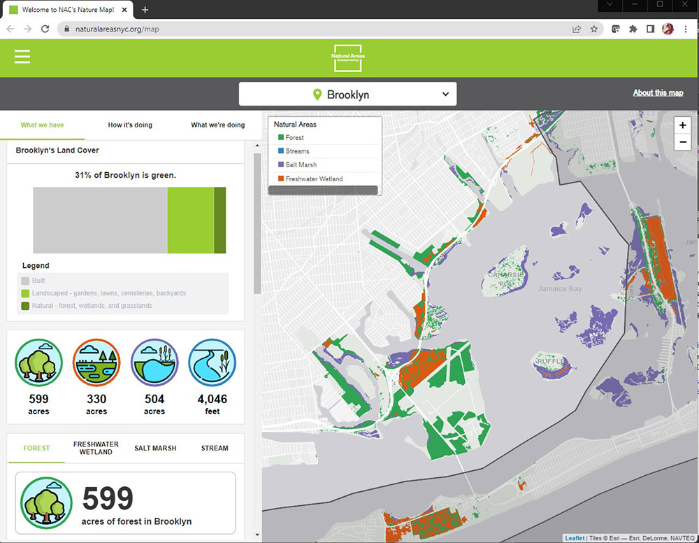
Enable citizens to make informed decisions about communities with real-time maps
Gain an integrated data picture of national forests, wildlife habitat, public transportation, and more
Monitor and measure results with data models, dashboards, and multi-dimensional visualizations

Modernize day-to-day operations such as inspections, maintenance, and construction

Support decision making through descriptive, historical, and predictive data analytics
Accomplish your mission with location
A modern geospatial enterprise enables you to produce intelligent maps, conduct spatial analysis, and visualize the results through location-based dashboards, web maps, and mobile apps. Create, capture, integrate, and analyze diverse data to derive better policy, planning, and engagement with stakeholders and the public.
Planning
Design resilient and sustainable communities, infrastructure, and management strategies for public lands and resources. High-powered spatial analysis and data visualization enable you to have a holistic view to understand goals and project impact.
Facilities and infrastructure management
Assess facilities, networks, assets, and lifecycle performance, as well as predict infrastructure failure and plan replacement. Geo-intelligence and maps provide intuitive methods to manage cost and resources for fixed and moving assets.
Land management
Effectively managing land and natural resources for operations, sustainability, development, and recreation requires a data-driven approach to modern complexity. Geospatial solutions improve administration and governance using a location-based approach.
Safety and security
From law enforcement to energy and emergency management, you can deliver location-based situational awareness using modern GIS. Combine real-time data with mobile mapping to view events as they evolve.
Communication
Collaborate across domains and agencies to enable stakeholders and citizens to make informed decisions about their communities. Garner public support, encourage feedback, and quickly share intuitive map information with citizens and stakeholders.
Why work with Locana?
For decades, Locana has served government entities around the world. With deep experience and proven project success, we deploy a unique delivery model that caters to your agency or project needs. We have a proven track record working in the public sector as a trusted partner to deliver location-based systems and applications that improve operational efficiency and government services.
What you gain:
![]()
Extensive government consulting experience
![]()
Accessible systems with secure, shareable, and authoritative data
![]()
Side-by-side collaborators with an agile approach
![]()
Proven track record delivering self-sustaining, self-sufficient projects
![]()
Commitment to delivering public trust through evidence-based policymaking
Learn more

Why Location-based AI Is the Right Choice

Location-based AI Delivers a Differentiated Advantage

Modern Geospatial Delivers Innovation

Supply Superior Government Services with Modern Geospatial Solutions
Bolster your infrastructure development
The American Rescue Plan (ARP) enables government organizations to create healthier, more resilient communities, cleaner environments, and greater economic growth using the latest GIS technology. Let Locana, an Esri platinum partner, help you maximize your delivery of new and improved services.


Expert geo-enabled government
Locana’s experience partnering with agencies at the federal, state, and local level means we understand the public sector. Our teams have built lasting relationships with clients just like you. Our dedication to serving the government means we use the right technologies purpose-built to your needs, so you gain maximum value on time and budget.
Let’s connect
Contact us today to learn more about what we offer and how we can deliver for you.