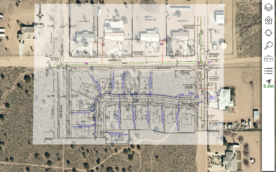
Locana helps implement Esri ArcGIS ArcGIS Utility Network, ensures successful data migration, and optimizes results.
GREENWOOD VILLAGE, CO (June 14, 2022) — Locana, a global leader in technology consulting and geospatial systems development, announced Brookings Municipal Utilities (BMU) successful deployment of a modern geospatial enterprise leveraging Locana services. The solution, built on the Esri ArcGIS System, including the ArcGIS Utility Network (UN), removes silos to create timely, accurate, and complete information used for improved decision-making. BMU selected Locana as its geospatial implementation partner after initially planning to execute much of the project with Locana in a support role.
“We gave Locana a goal to go live in April of 2021, which was a six-month time frame from the start date.”
— Russ Halgerson, Electric Department Manager, BMU
“We gave Locana a goal to go live in April of 2021, which was a six-month time frame from the start date,” said Russ Halgerson, Electric Department Manager, BMU. “They did the bulk of the work, communicating with us regularly, including weekly meetings. It was a successful project that met the goals we set out.”
The goal of the implementation was to replace legacy mapping with an enterprise GIS solution that would integrate data, leverage powerful analysis capabilities, and provide a foundation for the future. After an initial collaborative needs assessment, which included the Locana Collaboration Spectrum evaluation, BMU asked Locana to take on the responsibility of the lead consultant. As a result, Locana developed a detailed GIS roadmap and strategy to streamline the implementation based on extensive experience with previous UN implementations.
A key contributor to the successful enterprise GIS deployment involved Locana’s Advanced Rapid Migration Engine (CARMEN). Locana used CARMEN to migrate the electric data from the source systems and implemented containers and associations. This resulted in a fast, efficient data migration that might otherwise require significant time, resources, and investment by BMU.
BMU has now transitioned from departmental GIS to a spatially-enabled enterprise, facilitating easy access to comprehensive maps and related information across departments. The company replaced ad-hoc legacy maps with a network model that more closely aligns with their real-world system. They have a secure, modern technology to scale for the future, enabling smooth integrations with new systems as they are implemented.
About Locana
Locana, a location and mapping technology company, provides software products and services that solve the world’s most pressing business, climate, and social challenges. With more than 20 years of experience, Locana is a global leader in both enterprise geospatial solutions and innovative applications using proprietary and open‐source mapping technologies. By taking a location‐first approach to problem solving, Locana builds, implements, and connects solutions for public and private customers, in a wide range of domains including: utilities, land and facility management, critical infrastructure, defense, conservation, international development, and technology, among others. With headquarters in Greenwood Village, CO., the company also has major offices in Seattle and London. For further information visit: www.locana.co or https://www.linkedin.com/company/locana-co/.
###
Editor’s Note: Interviews with company executives are available upon request.
Contact:
Jennifer Dulles, APR
DStreet for Locana
Phone: 303-956-0001
Email: jdulles@dstreetpr.com


