
Location-based solutions supply big business value to your operational data and applications
Data quality and completeness matter
The cost of doing business has never been more data-driven. Indeed, as data quantity continues to rise exponentially, data quality becomes harder to attain and more valuable. Without it, companies not only perform poorly but also lose money.
Gartner estimated poor data can cost companies $15 million a year on average. And other research estimates companies lose up to 30% of revenue on average due to low data quality. For businesses to thrive in a data-driven economy, they need quality that ensures optimum decision-making and a competitive edge.
That’s where location-based data enrichment comes in. Using various data optimization methodologies and toolsets, data enrichment facilitates improving your systems, applications, products, and services that rely on high-quality data. Specifically, location-based enrichment organizes and integrates information around geography, connecting data stored in multiple departments and from 3rd party vendors.
Whether adding location to existing data or using location to integrate information, location-based enrichment improves timeliness, completeness, and accuracy, so you make better decisions and optimize operations.
When your data needs help
The need to improve data through enrichment can come from multiple places. Enterprise system implementations, digital transformation initiatives, and software upgrades often shed light on data quality issues that might otherwise go unrecognized. For example, siloed applications can lead to redundancy, which impacts productivity and costs.
In addition, the initial data capture in certain processes can lead to inaccuracies. Many utilities derive asset and infrastructure data from field drawings. The very nature of the manual process can impact quality. Even pencil thickness can affect accuracy by ten or more feet, for example, when drawing underground pipelines. Organizations may have digital data derived from original hand-drawn field maps, with the digitization process resulting in translation mistakes.
For a long time, GPS-related data was considered precise. Yet, for things like transmission areas, connectivity can be poor or not digitally captured at all. And in city areas, refracting off buildings means GPS data may not be accurate.
When companies start correcting the spatial identity of assets or pipes, it’s typically labor-intensive. And once you start moving assets around, you need a QA/QC process to make sure movements are correct, which is not merely a slip of the mouse.
For most data improvement and enrichment projects, utilities struggle to go full board because it can be cost-prohibitive. They can do small sections per year based on staff on hand, and it takes a long time, including ten or more years, if you’re doing it with internal resources. Given the exponential growth of data sets, even in the best situations a company can still find themselves behind the pace.
What’s needed are tools that perform high-value data corrections. And, the more you automate the processes involved with the corrections, the more effective you can be to continually update and correct data moving forward.
Delivering trustworthy data
Location-based data enrichment solutions build trust in an organization’s data. And it allows companies to take advantage of the locational aspect of their data. They gain a more complete data picture, including business-critical analysis missed using traditional tools.
Companies can consume external information sources to augment their databases. As a result, they extend data completeness for operations, products, and services while improving safety and reducing risk. It also allows them to organize information around geography.
For example, many organizations in utilities, government, and the commercial industry today are considering how climate change will affect business operations, commodity delivery, and supply chains. Most of these organizations do not generate climate data. Instead, they can bring in relevant climate data that enriches existing operations databases. This allows them to understand better how climate change and adaptation can be addressed as part of their strategy.
They can also add attributes to field equipment, conductors, and more to identify and document equipment with greater granularity. This increases the expectation of data quality and completeness because data QA/QC is built into apps, ensuring users fill out certain information as part of their daily activities.
For example, to support new construction projects and as-built documentation, companies can deploy apps that require certain attribution for regulator station equipment records going into the GIS. You can employ a runtime validation that requires all of the appropriate information to be entered with the creation of a regulator valve.
Specifically, companies can employ automated processes that ensure accurate and timely data capture in three key areas:
- Compliance: As regulators and public utility commissions increase their sophistication to do audits that go beyond software and into systems that include GIS data, organizations are using data enrichment to detect inaccuracies much faster and with greater accuracy, ensuring their compliance.
- Operational efficiency: Whether managing assets or field services, businesses are understanding how enriched data provides a more timely, complete, and accurate data picture to operate more efficiently. Knowing things like what assets are required where and for which jobs allows back-office and warehouse staff to more effectively load trucks and transport equipment to the right location.
- Safety: For customers, staff, and the community, high-quality data offers improved safety and reduced risk, especially around inspections, maintenance, repairs, and construction of new electric, gas, and water assets. You equip your staff with correct information that helps keep services running safely, even during repairs.
Especially for utilities and other businesses that maintain large volumes of good data, opportunities remain for spatial improvement in accuracy and completeness. For example, improving substation or regulator station data to include more attributes, such as asset type, serial numbers, and material type ensures regulatory compliance and efficient maintenance of the assets. While utilities may maintain one point for the location of a substation, they often must look at a related data table that lists the assets located at that station. Enrichment solutions facilitate creating a complete GIS with detailed attributes. They replace engineering line diagrams that lack spatial accuracy with locationally-correct maps.
Your data is your business
Materials tracking and traceability

Ensure accurate information for full lifecycle traceability and maintenance. You can enrich infrastructure information with vital details used on materials and equipment for more efficient and effective regulatory compliance and oversight. For example, companies can record asset and material information to GIS, work order, and asset management field and back-office applications; document GPS/GNSS locations; scan, decode, and record ASTM F2897 barcodes; as well as auto-populate F2897 fields.
Automated Service Line Correction

Increase safety and performance while reducing risk using data enrichment for utility service lines. Companies can deploy automatic, repeatable processes that assess data quality and make corrections. This can be enhanced with comparative data sources to identify the highest-fidelity information source that provides location precision. Then, conflate the location attributes and generate higher-accuracy service line datasets.
OpenStreetMap data
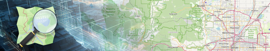
Enhance your OpenStreetMap data using refined tools that ensure clean and fit-for-purpose data. From OSM data related to public lands to street and building data, companies can improve the accuracy, completeness, and timeliness of base datasets, as well as take advantage of open-source tools for better data quality.
Automated design

Working with SBS, Locana helps companies optimize designs and more efficiency generate and record asset and GIS data. By combining digital mapping with intelligent design, asset management for materials, and work order management, organizations can take design accuracy and efficiencies to a new level. Businesses in the electric, gas, and telecommunication industries standardize designs, streamline workflows, and make better decisions.
3D facility mapping

Reduce facility mapping from days and weeks and even hours. In conjunction with GeoCam, Locana offers 3-D imagery collection and AI-driven analysis, classification, and feature creation. Organizations can develop or upgrade vector features and generate digital representations such as point clouds. In addition, they can auto-generate records and attribute information related to facility equipment, including z-axis-enabled location.
Data services for your business
For companies looking to take the first steps into data enrichment, Locana can help. Locana’s data enrichment solutions feature world-class capabilities built on decades of expertise. Our experienced staff maintains highly technical data enrichment knowledge used to develop and launch toolsets and patterns of excellence. Through our broad exposure to both open-source and proprietary data, we have crafted best practices for building data pipelines and processes that combine the latest GIS, modern technology, and industry expertise. We have delivered results for customers in government, commercial, utilities, clean energy, nonprofits, and more.
Specifically, we have a methodology for assessing a company’s needs and developing an execution strategy that delivers better data. It includes:
- Discovery: Staff uncover insights into the current IT environment using workshops, interviews, and data assessments. We identify challenges and opportunities for success using a holistic approach that includes people, processes, products, and data environment.
- Design: We build a client-specific strategy that includes business and IT goals, roles, and tactics, as well as IT architecture, services, databases, software, applications, 3rd party data, and more. We include all attributes that go into supporting business and IT needs.
- Implementation: Staff build data enrichment solutions that include GIS and enterprise software, data quality comparison tools, servers, data loading, training, and more.
- Support: We provide ongoing support services that include feedback loops, data maintenance, monitoring, and upgrades.
Increased business performance through data
As more companies digitally transform their processes, data becomes the great differentiator between business success and failure. And because of this, data enrichment offers tremendous advantages. Through proven, repeatable tools, methodologies, and techniques, companies can improve the quality of their data, generate new data and insights, as well as bring in 3rd party data sources that provide additional value. This helps enhance data quality and analytics to improve a host of business decisions, from building new products and services to compliance, operations, customer support, and more.
Locana has partnered with companies across industries and around the world to achieve better business outcomes through enriched data. Our proven enrichment solutions have been refined over decades, helping clients optimize their data and technology. We help others replace manual, time-consuming data processes with efficient workflows and open new opportunities with previously unattainable data sets. Organizations improve decision-making at every level using timely, complete, and accurate data that becomes the operational standard for success.


