
Transform business operations and more using data science services that deliver
Flexibility and power to fit within existing IT
With advances in technology, exponential explosion of data, and global adoption of consumer-level applications, 2023 has been a break-out year for artificial intelligence (AI). The global AI market is valued at over $136 billion, and the industry is projected to increase by 13 times over the next seven years.
More businesses than ever are cautiously evaluating the potential to deploy AI in the enterprise, what knowledge, skills, and experience are needed, and what guardrails to put in place to ensure security and reduce risk. Where and how to begin can be challenging for businesses looking to do more than consumer-level applications. Moreover, organizing and taking advantage of diverse information, including unstructured and big data, becomes another hurdle to overcome.
What’s exciting and yet to be fully realized—the advancements in AI, combined with location-based technology, hold the tremendous opportunity to deliver solutions that build better processes, remove mundane and time-consuming activities from employee’s to-do lists, and transform functions into lean, efficient, and low cost operations.
Modern geospatial technology combined with AI empowers organizations to deploy leading-edge use cases across a spectrum of applications. Companies can automate processes, detect and fix errors, predict trends, and optimize assets using custom-trained models that leverage location. By coupling location intelligence with AI, businesses improve accuracy and gain deeper insights—and gain a competitive edge.
As AI evolves, demand explodes
As AI increases in daily use through consumer applications, more brands will deploy these tools for personalized experiences because they are faster and more convenient than traditional business interaction. And that increased use sets up demand for more business-focused applications, which explains why the AI market size is expected to reach $407 billion by 2027.
While utilities, commercial businesses, nonprofits, and government agencies plan to invest in AI and ML, developing the proper solutions can be challenging for several reasons. For starters, there remains a lack of training about how to deploy available tools for industry-specific business tasks. In addition, there is a lack of available data for training these business-focused models. For example, utility companies may lack the necessary data and imagery around infrastructure, such as electric lines, so organizations must figure out how to find viable data sources or build them themselves.
Most businesses lack the in-house expertise to select, build, train, deploy, and validate models. And there remains a lack of machine learning engineers and data scientists in the marketplace. Perhaps most importantly, businesses must contend with how to protect their customer data and high-value data, such as critical infrastructure, as part of the process. Questions remain about how to protect customer data for more operations-oriented edge use cases.
That’s where AI sub-disciplines of machine learning (ML), computer vision (CV), and natural language processing (NLP), combined with location, can make a difference for companies looking to embrace edge use cases. Combining AI and geospatial technologies helps capture, connect, and organize data in-house and externally. They can then automate large-scale tasks, extract insights from enormous data stores, and make accurate predictions to improve processes. They can use AI applications to remove manual, mundane, and time-consuming duties from employees, who can then focus on higher-priority work.
With the proper engineering and data science expertise and experience, companies can employ custom-trained models to detect, capture, and classify features and attributes from raw data, such as imagery. Inference techniques help detect, capture, and classify features and characteristics from raw data sources, from social media to satellite imagery and surveillance cameras.
The benefits of Locana’s location-based AI:
- Augmented workforce capacity and enhanced productivity
- Improved forecasting, decision-making, and performance
- Automated and simplified workflows and processes
- Enhanced products, services, and customer care
- Optimized assets, operations, and infrastructure
Location-based AI means business
Combining AI with geographic information system (GIS) technology delivers value across business-oriented industries and applications. Below are just a few examples of how location-based AI benefits diverse operations and uses cases.
Products

Products — You can add location intelligence to your existing product using machine learning to connect different data types. You can use inference techniques to carry out intelligent correlations, as well as add contextual data to enrich the products you have. For example, you can have a product, such as a travel website, that embeds maps, pulling other information in such as points of interest, relevant local events and geo-tagged social media content.
Real estate

Real estate — Natural language processing and machine learning can help direct a real estate buyer to a home or neighborhood that matches their preference and would increase the likelihood that a customer would be happy in that space. It can reduce the number of unproductive showings before they make an offer and a realtor successfully closes, giving time to back agents to increase deal flow, ultimately leading to more sales.
Customer service
Customer service — Natural language processing allows for topic modeling and signal detection, so companies can take comments people make using their mobile device (like a downed tree on a street or a broken water main), run them through a natural language processor, and pull out keywords to build a summary of comments. Those items can then be geo-referenced to create an issue heat map that depicts where issues are occurring so companies can effectively respond.
Operations
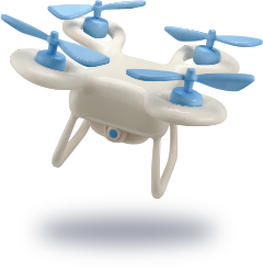
Operations — Locana has a lot of customers interested in reducing field service trips that involve sending people to inspect things like infrastructure, fence lines, reservoir water levels, vegetation encroachment, and more. They can use AI to enhance inspection duties that reduce labor and non-productive time driving from place to place. In addition, they can use a drone to fly along a fence line or over a reservoir, then use computer vision to identify items such as a break in the fence or debris in the reservoir.
NGOs

NGOs — Organizations can use AI to detect where reforestation is needed for things like conservation. In addition, they can use CV-based imagery processing and ML algorithms to determine if trees are growing correctly and no longer need to be monitored. They can evaluate human and wildlife interfaces to ensure human activities don’t encroach on wildlife areas, and wildlife areas don’t cause risk to human infrastructure through floods or wildfire risk from overgrown vegetation, for example.
Nonprofits

Nonprofits — One of the greatest challenges for nonprofits is budget and labor cost constraints. AI can reduce both, providing a force multiplier for processing data and performing duties such as medical and scientific surveys, agricultural assessments, and more. Geo-based AI can provide low-cost, on-demand capacity for resource-constrained operations to replace more costly and resource-intensive tasks.
Commercial
Commercial — For businesses supplying location-based services, geospatial AI tools help enable near-real time maps at a global scale. It enables cleaning up volunteered data and determining confidence levels prior to application use. CV and ML solutions can help process video from devices such as car cameras or buildings for faster, more efficient updates.
These application areas and more take advantage of location-based AI and machine learning models that facilitate capabilities including:
- Facilities monitoring using security cameras and computer vision models
- Location inference from unstructured text and natural language processing
- Computer vision for object identification and feature extraction
- Creation of synthetic location indices via density/accessibility classification
- Image assessment at scale for photos associated with geographic features
- Automatic attribute enrichment using image detection and object counts
An AI leader you can trust
Employing an integrated geospatial approach to your AI efforts can bring a bounty of benefits without acquiring more staff and expertise. Locana’s proven, repeatable tools, methodologies, and techniques allow for effective deployment you can trust. Our deep technical expertise and customer experience help accelerate initiatives and ensure success for any business need.
Numerous customers today have partnered with Locana to streamline workflows—from data capture to finished product. Locana maintains formal protocols for identifying where and how to apply AI tools to most business processes to reduce the burden on workers and improve performance.
For example, capturing raw data and extracting data from imagery is tedious work that’s low-skilled, time-intensive labor, the type of work people do not want to do. By applying ML, companies can automate the workflow so that staff can carry out work they enjoy that also supplies greater value to the organization. In another example, Locana works with utilities constantly to inspect infrastructure for deficiencies (like corrosion) or damage from weather events. Companies can reduce costs of operations and maintenance using AI for inspections.
Location-based AI means better operational performance
The exponential growth of AI adoption and available data has created a new need for more business-savvy, leading-edge use cases. Geospatial technology combined with AI tools and services provides tremendous value and opportunity for businesses looking to transform operations, services, and products. With a trusted partner like Locana, companies can quickly implement solutions at a reduced cost and in a fast, efficient manner.
***
Want to learn more about how you can gain a competitive advantage with location-based AI? Visit our innovation and services pages.


